
3 Minutes
Travel Back in Time with Google Earth’s New Feature
In celebration of its 20th anniversary, Google Earth has rolled out a groundbreaking update that empowers users to glimpse the evolution of cities and neighborhoods through historical Street View imagery. This innovative feature allows tech enthusiasts and urban explorers to seamlessly journey back in time and witness how streets, skylines, and city blocks have transformed over the years—all with just a few clicks.
Historical Street View: Visualizing Change Like Never Before
Previously available on Google Maps, the ability to access archived Street View photos is now fully integrated into Google Earth’s platform, serving as an invaluable tool for those interested in urban development, historical research, and geography. Users can toggle between different years to compare how specific locations have evolved, turning Google Earth from a simple mapping tool into a dynamic archive of visual history.
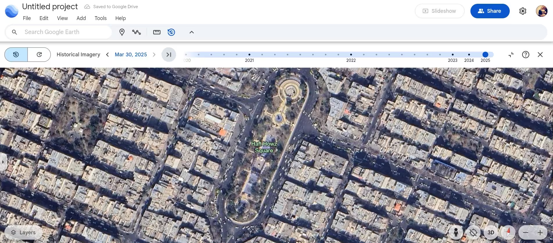
Satellite Imagery Comparison: Expanding Perspectives
Google has also extended the ability to compare satellite and aerial imagery from various years within the desktop version of Earth Pro—a feature now available to all users worldwide. For example, viewers can examine aerial changes in Tehran’s iconic Haft Hoz Square by contrasting images from 2021 and 2025. However, it’s important to note that while satellite imagery is accessible for most regions, historical Street View may currently be limited or unavailable in certain areas, including Iran.
AI-Powered Insights for Professionals
Further enhancing its appeal for urban planners and environmental specialists, Google Earth now offers advanced analytics powered by artificial intelligence. These tools provide detailed data on land surfaces and climate shifts, including visual overlays that highlight shaded tree coverage in urban zones. Such insights enable experts to identify neighborhoods in need of additional cooling solutions or tree planting.
Optimizing Urban Heat Management
Beyond historical imagery, Google Earth is set to introduce surface temperature data, giving city managers and researchers the ability to pinpoint urban heat islands and make informed decisions to tackle rising temperatures. According to Google, these advanced features will become widely available to users around the globe in the coming weeks.
Market Relevance and Use Cases
With these updates, Google Earth solidifies its position as a leading platform for visualizing urban changes, planning city infrastructure, and supporting climate resilience efforts. Whether you’re a tech enthusiast, professional planner, or simply curious about your hometown’s transformation, Google Earth’s latest tools offer a unique blend of usability and innovation for both personal and professional exploration.

Comments