3 Minutes
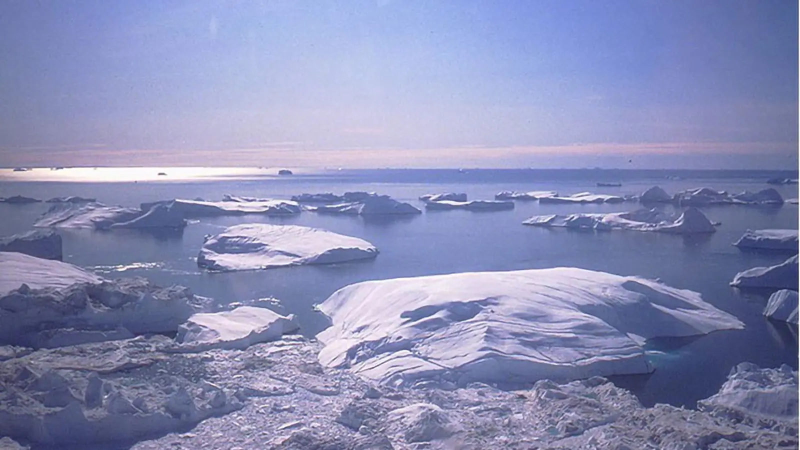
Icebergs in Disko Bay (West Greenland) discharged by the Jakobshavn Isbrae, one of the fastest moving outlet glaciers in the world. Mass loss from the Greenland Ice Sheet has contributed nearly 2 cm (three quarters of an inch) to global sea-level rise over the past three decades. Credit: Torbjörn Törnqvist/Tulane University
Satellite era validates early climate projections
Three decades of satellite altimetry and ocean monitoring confirm that mid‑1990s global sea‑level projections were broadly accurate, though they underestimated contributions from melting ice sheets. A new analysis by Tulane University researchers, published in Earth’s Future, compared the Intergovernmental Panel on Climate Change (IPCC) projections made in 1996 with the observed rise recorded since satellite measurements began in the early 1990s.
The 1996 IPCC assessment predicted roughly 8 cm (about 3 inches) of global mean sea‑level rise over the following 30 years. Observations show the global mean rose by approximately 9 cm — a close match. However, the models at that time underestimated the pace of ice loss from the Greenland and Antarctic ice sheets by more than 2 cm (roughly one inch).
Scientific background and measurement advances
Satellite altimetry missions beginning in the early 1990s (for example, TOPEX/Poseidon and later the Jason series) established continuous, precise measurements of ocean surface height. Combined with tide gauges and gravity‑mission data, these missions allowed scientists to resolve both global trends and regional patterns in sea‑level rise. Over the 30‑year record the average rate equated to about one‑eighth of an inch per year; more recently, NASA analyses indicate that this rate has doubled over the full period.
Regional variability and drivers
Sea‑level rise is not uniform. Regional differences are driven by ocean circulation changes, atmospheric patterns, land‑water storage, and gravitational and flexural responses to mass redistribution as ice melts. The Tulane study emphasizes that improving regional forecasts — translating global projections into local, actionable sea‑level scenarios for vulnerable coastlines such as south Louisiana — is an urgent priority for planners and policymakers.
What was underestimated: ice‑sheet dynamics
Early models had limited representation of how warming ocean waters could destabilize marine‑based sectors of the Antarctic Ice Sheet from below, and of rapid changes in outlet glacier flow in Greenland. Observations showed both faster ice discharge and more complex feedbacks than anticipated. Those gaps help explain why ice‑sheet contributions to sea‑level rise were larger than predicted and why projections now include a wider range of possible outcomes, including low‑probability but high‑impact scenarios such as rapid ice‑sheet collapse.
For coastal communities and infrastructure planners, that uncertainty translates into a need for flexible, risk‑aware strategies that account for both the central estimates and the tails of the probability distribution.
Expert Insight
"The comparison between early projections and 30 years of observations gives us confidence in the basic physics embedded in climate models, but also highlights the central role of ice dynamics — a frontier in cryosphere research," says Dr. Maya Alvarez, a fictional coastal systems scientist. "Investments in sustained satellite missions, in situ glaciological campaigns, and high‑resolution regional modeling will determine how effectively we can translate global forecasts into local resilience planning."
Conclusion
Long‑term satellite records have validated key elements of 1990s sea‑level projections, demonstrating that climate science has had robust predictive capacity for decades. At the same time, the stronger‑than‑expected contribution from melting ice sheets underscores persistent uncertainties in ice dynamics and the need to sharpen regional forecasts. Continued support for satellite altimetry, gravity missions, tide‑gauge networks, and coastal planning tools is essential to anticipate and manage the evolving risks of sea‑level rise.
Comments
No comments yet.
Leave a Comment