2 Minutes
New evidence for wide prehistoric networks
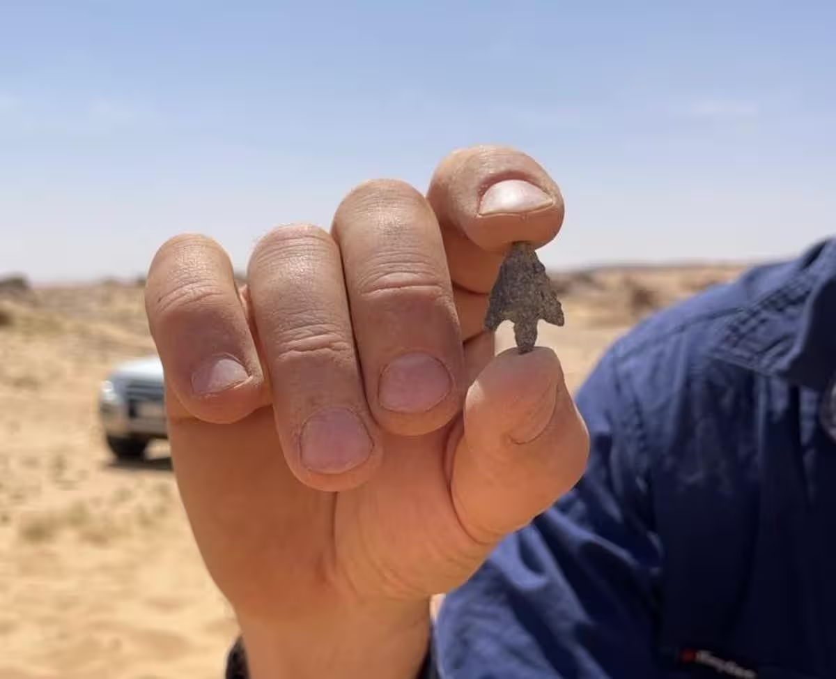
Researchers studying prehistoric rock art in Arabia have found material evidence that the artists were part of a broad, long-distance cultural network. The objects discovered alongside the engravings — stone tools and personal ornaments — match styles known from communities in the Levant some 400 kilometres to the north. This link suggests people exchanged technologies, goods or ideas across substantial distances during the terminal Pleistocene.
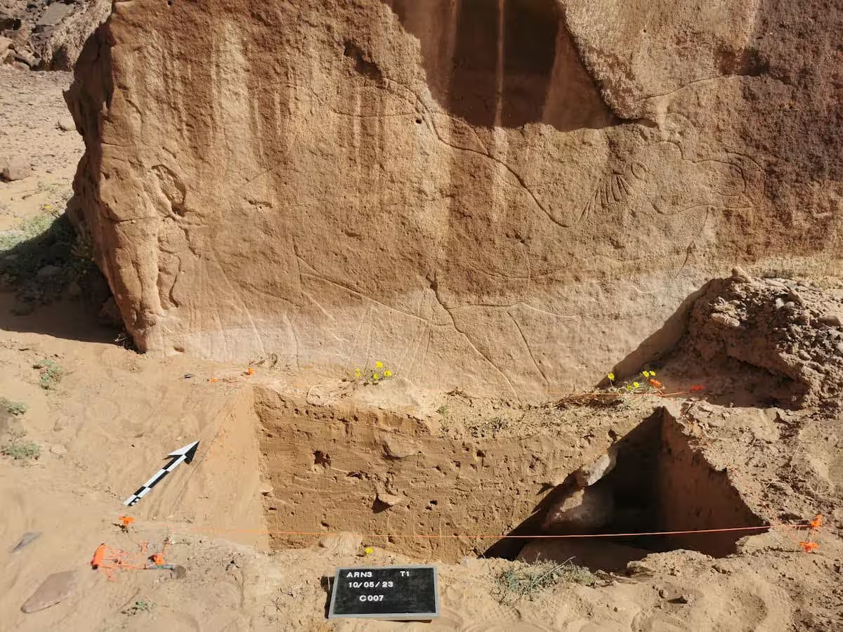
Palaeoenvironmental context and dating
Seasonal lakes and a changing climate
The team found the rock art was deliberately placed near ancient seasonal lakes. These paleolakes are dated at roughly 15,000 years ago, providing the first clear evidence for the reappearance of surface water in parts of Arabia after the extreme aridity of the Last Glacial Maximum (the cold, dry interval near the end of the last ice age). By pushing the timeline for returning humid conditions back by millennia, these findings expand the window of opportunity for human groups to occupy and move through the interior desert.
Human behaviour and survival strategies
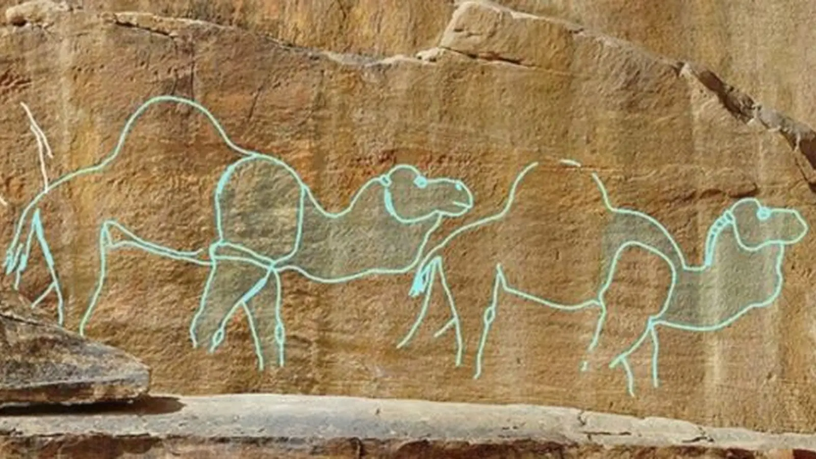
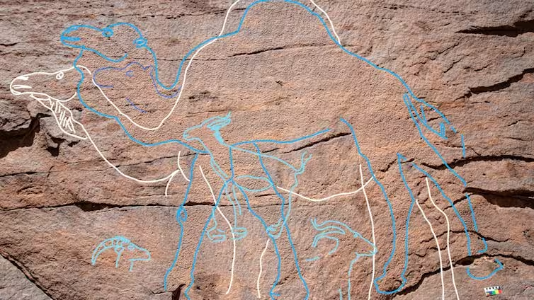
Around 12,000 years ago, people evidently exploited these temporary water sources to survive in otherwise inhospitable desert landscapes. The rock art appears to mark reliable water points and the routes leading to them, serving as monumental wayfinding cues. Researchers emphasize that the specific motivations for creating these markers remain unknown: they could be territorial, ritual, directional, or practical.
The imagery includes a prominent camel motif — a powerful symbol of desert endurance even for modern observers. Whether camels were depicted as literal resources, ancestral animals, or symbolic emblems is still a subject for interpretation.
Implications for archaeology and climate history
These discoveries link archaeological evidence (tools, jewellery, and rock art) with regional palaeoclimate data, improving our understanding of how environmental change shaped prehistoric human mobility, settlement, and cultural exchange across Southwest Asia. Future work integrating sedimentary analysis, dating of associated materials, and regional surveys will refine the chronology and the reasons communities invested in these large-scale, landscape-level markings.
Conclusion
The presence of rock art near dated seasonal lakes demonstrates how shifting climate created new opportunities for human habitation and cultural interaction in Arabia. These signs on the stone record both survival strategies and long-distance connections that helped prehistoric peoples navigate and thrive in changing environments.
Comments
No comments yet.
Leave a Comment