4 Minutes
Silverpit confirmed as an asteroid impact
New multidisciplinary research has resolved a long-standing geological controversy by confirming that the Silverpit structure, buried beneath the southern North Sea, is a genuine hypervelocity impact crater. The international team, led by Dr. Uisdean Nicholson of Heriot-Watt University and supported by the Natural Environment Research Council (NERC), combined high-resolution seismic imaging, microscopic study of subsurface rock cuttings, and numerical impact modeling to demonstrate that an extraterrestrial body struck the seabed roughly 43–46 million years ago.
Silverpit lies about 80 miles off the Yorkshire coast and is centered some 700 meters beneath the seabed. The crater itself measures roughly 3 kilometers across and is surrounded by a 20-kilometer ring of concentric faults. Those dimensions, together with the new microscale and seismic evidence, make Silverpit one of the best-preserved underwater impact structures known.
Evidence and methods: seismic imaging, shocked minerals, and models
The research team used recently available seismic datasets that provide unprecedented detail of the crater's internal geometry. The seismic surveys reveal a distinct central uplift and the ring-fault architecture expected for an impact formed by a high-velocity object arriving at a low angle.
Crucially, drill cuttings recovered from an offshore oil well intersecting the same stratigraphic level as the crater floor contained shocked quartz and shocked feldspar grains. These mineral fabrics record extreme, transient pressures and strain rates that cannot be produced by ordinary sedimentary or tectonic processes — they are diagnostic evidence of an impact. Finding such shocked minerals in a narrow borehole is extremely fortunate and helped to tip the balance in favor of the impact interpretation.
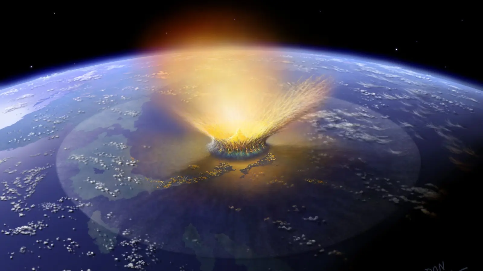
Numerical simulations supplied by collaborators reproduced the observed crater geometry and faulting when a ~160-meter-wide asteroid (about 530 feet) strikes the seabed at a grazing trajectory from the west. Models indicate that the impact excavated and lofted a curtain of rock and seawater up to 1.5 kilometers high before collapsing back into the ocean. That collapse, the researchers estimate, would have generated a tsunami exceeding 100 meters (roughly 330 feet) near the source — a catastrophic regional wave height by any standard.
Scientific context and implications
Hypervelocity impact craters are rare in the stratigraphic record because Earth’s active geology — erosion, sedimentation, and plate tectonics — tends to erase their signatures. On land, about 200 impact structures have been confirmed; beneath the oceans, only a few dozen have been identified so far. Silverpit’s exceptional preservation offers a rare opportunity to study crater formation and post-impact deformation in marine settings.
The confirmation of Silverpit adds to a growing catalogue of confirmed marine impacts, such as the Chicxulub crater in Mexico (linked to the end-Cretaceous mass extinction) and the recently confirmed Nadir Crater off West Africa. Understanding the scale and frequency of such events helps researchers constrain impact hazards and the potential for tsunamis triggered by submarine collisions.
Dr. Uisdean Nicholson commented on the discovery, noting that the combination of advanced seismic imaging and fortuitous drill core evidence produced a decisive dataset. Professor Gareth Collins of Imperial College London, who provided the numerical models, said the new results finally supply the missing physical link between observed structure and process.
Related technologies and future prospects
This study demonstrates the value of integrating hydrocarbon-industry seismic archives with targeted mineralogical analyses and state-of-the-art impact modeling. Future work will likely include 3D seismic reprocessing, targeted coring to recover in-situ shocked materials, and refined numerical simulations to explore ejecta distribution and tsunami run-up scenarios.
Beyond improving our geological understanding, these findings have practical relevance for coastal hazard assessment. Although large marine impacts are rare on human timescales, better quantification of their potential tsunami generation mechanisms can inform emergency preparedness and risk modeling for vulnerable coastlines.
Expert Insight
"Silverpit provides a unique window into how an asteroid interacts with a marine environment," says Dr. Elena Morales, an astrophysicist and planetary geologist (expert commentary). "Because the structure is so well-preserved, we can test models of ejecta emplacement, crater collapse, and tsunami generation that are otherwise difficult to validate on Earth. Those same models help us interpret impact records on other planetary bodies where we only have surface observations."
Conclusion
The confirmation of Silverpit as a hypervelocity impact crater reconciles a decades-long debate and highlights the power of combining seismic imaging, mineral-scale forensics, and numerical modeling. The 160-meter projectile that formed Silverpit not only produced a classic multi-ring impact structure but also likely triggered a towering tsunami, underscoring the dramatic local consequences of submarine impacts. As seismic archives and analytical methods improve, additional buried craters may be identified, offering deeper insight into Earth’s impact history and refining assessments of future extraterrestrial hazards.
Comments
No comments yet.
Leave a Comment