3 Minutes
Deep beneath the Yucatán Peninsula, a watery labyrinth keeps yielding secrets. Sistema Ox Bel Ha — the Maya name for "Three Paths of Water" — has now been mapped to 524 kilometers (325.6 miles) of submerged passageways, making it the longest known underwater cave system on Earth. And explorers say the survey is far from finished.
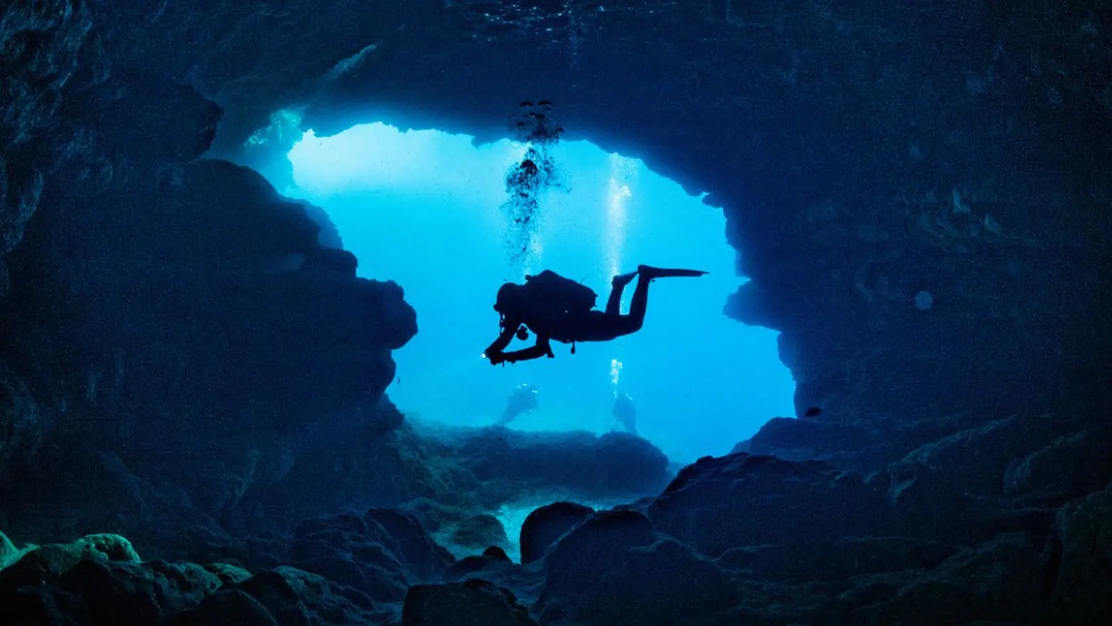
How explorers measure a hidden world
Ox Bel Ha sits near Tulum, Mexico, and unlike dry caves such as the Mammoth Cave system in Kentucky (which measures at least 686 kilometers or 426 miles), it is almost entirely flooded. That makes exploration technically demanding: cave divers must manage oxygen reserves, trim buoyancy precisely, and install guideline reels that provide both a lifeline to the surface and the metric by which new passages are counted.
Surveying under pressure
- Teams progressively extend lines through narrow tunnels and vast chambers, documenting depth, direction and distance.
- Mapping is incremental — when a line is re-surveyed and connected to other passages, the reported length can jump by kilometers overnight.
- Specialized gear, redundancy protocols and careful decompression planning are standard to keep divers safe during long survey dives.
From discovery to expansion: a modern exploration saga
Although local people knew of cenotes and sinkholes for centuries, Western explorers only began documenting Ox Bel Ha in 1996. Systematic dives and surveys took longer to organize, and it’s been a decades-long effort by conservation groups and specialist teams to map the network. In recent years, re-surveying old guideline lines revealed roughly 10 kilometers of previously unmapped passage, pushing the tally from about 496.8 kilometers to 524 kilometers, according to CINDAQ (El Centro Investigador del Sistema Acuífero de Quintana Roo).
Those newly connected corridors sometimes feel like archaeological time capsules: some chambers have produced hints of ancient Maya artifacts, while others open into spectacular voids — sinkholes and cavernous "ice-palace" formations sculpted by millennia of groundwater flow.
Why Ox Bel Ha matters
This system is more than a record-setting curiosity. It is a crucial part of the region’s aquifer: a freshwater highway that feeds cenotes, supports biodiversity, and has sustained human communities for millennia. Mapping Ox Bel Ha improves our understanding of groundwater routes, helps protect fragile subterranean ecosystems, and guides conservation plans for the Yucatán’s drinking water and cultural sites.
Exploration also advances diving science and technology. Each extended survey teaches teams how to move farther and safer into submerged karst systems — knowledge transferable to rescue operations, archaeological work, and environmental monitoring.
For now, Ox Bel Ha remains an active frontier. Cave divers and researchers keep probing, guided by thin reels of line and a blend of caution, curiosity, and the odd sense of wonder that comes from discovering passages no human eyes have seen before.
Comments
No comments yet.
Leave a Comment