5 Minutes
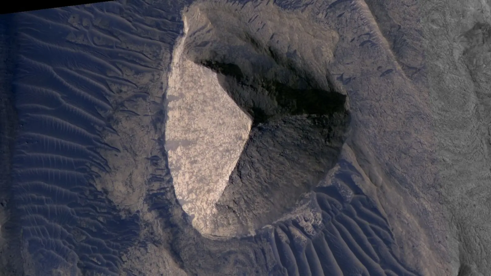
A dramatic triangle of shadow and light catches the eye: a three-sided peak tucked into the folds of Candor Chasma, one of the deep troughs of Mars. Seen at a glance, it looks like a deliberately carved pyramid — neat faces, sharp ridges, an uncanny symmetry that tempts the imagination. Photos circulated on social media and tabloid sites made the formation briefly famous, and the image sparked the familiar question: is Mars hiding an ancient structure?
What the images actually show
The imagery at the heart of the debate is real. Orbiters photographed the site first in the early 2000s with the Mars Global Surveyor, and later at much higher resolution by the HiRISE camera aboard NASA’s Mars Reconnaissance Orbiter. The formation, sometimes called the "Candor Tetrahedron," was first pointed out in a 2002 review of MGS frames. Since then the area has been reimaged several times, which helps scientists put the feature into context rather than treating a single snapshot as definitive evidence of anything extraordinary.
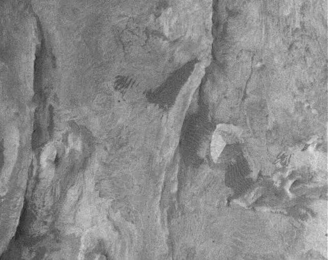
Zoomed-in HiRISE frames reveal texture. Wind-formed ripples lap at the base. The surface is pocked and uneven. The so-called pyramid does not present the crisp edges or repeating proportions that human-made pyramids typically show. Instead, it sits among a field of similar features: knobs of resistant rock that stick up like islands after softer surrounding layers have been stripped away.
Geology behind the pyramid shape
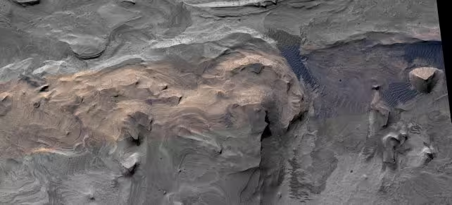
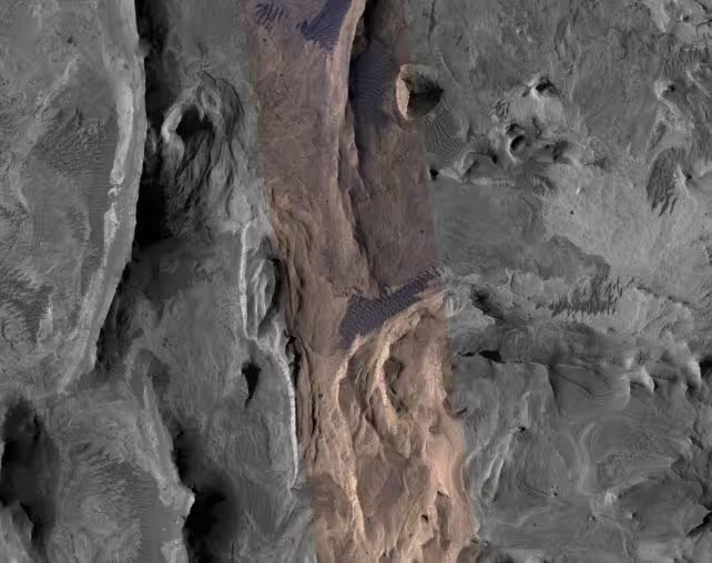
Candor Chasma belongs to the Valles Marineris system, a set of canyons carved by complex processes over billions of years. Water, landslides, wind, and perhaps tectonic stresses all played roles. Within that long history, layers of sediment and volcanic deposits were laid down, baked and fractured, then differentially eroded. The result is a landscape spotted with positive-relief knobs: remnants of formerly buried, harder rock that outlived the weaker material around them.
These knobs are not tiny curiosities. On Mars they can be hundreds of meters across and tens of meters tall. The Candor example measures roughly 290 meters across and reaches about 145 meters in height — impressive, but well within the known range for erosional landforms on the planet. Comparable pyramid-like mountains exist on Earth: Cerro Tusa in Colombia and the steep, conical peaks of China’s Guizhou province owe their forms to layering and erosion, not human hands.
There are clues in the surface detail that point to natural origins. Aeolian ripples attest to active wind shaping. The slopes show irregularities; the three apparent faces are not identical. Shadows change with viewing angle. This constellation of evidence is typical of pareidolia — our brain’s tendency to perceive familiar patterns where none were intentionally made. Humans are exceptionally good at finding faces and geometric shapes in noise. That talent serves social needs on Earth, but in planetary science it can mislead.
Understanding these knobs matters beyond debunking headlines. Their composition and stratigraphic relationships record episodes of deposition, burial, and erosion. Studying them helps reconstruct ancient climates, identify more resistant lithologies, and map the mechanical processes that have reshaped Mars’ surface. In short: they are geological archives, not artifacts.
Mission context and imaging technology
The Mars Global Surveyor supplied the earliest public views. Later, Mars Reconnaissance Orbiter's HiRISE returned far sharper images, capable of resolving features less than a meter across. That jump in resolution is what turns an ambiguous patch into a textured landform you can read. Remote sensing specialists combine multiple passes, different sun angles and spectral data to separate shadow trickery from real structure.
Future missions and instruments will add layers of certainty. Orbital radar and spectroscopy can probe material properties. A rover, if ever sent to this canyon floor, would render the definitive verdict: rock grain sizes, sedimentary structures, and mineralogy would tell the full story.
Expert Insight
"Images like this are perfect teaching moments," says Dr. Amelia Rivera, a planetary geologist who has worked with orbital imagery for two decades. "They show how pattern recognition and scientific context play different roles. A single photo can be arresting, but it’s the sequence of observations—different lighting, multiple instruments—that reveals process. The so-called pyramid is a window into erosion and stratigraphy, not engineering."
That is the practical takeaway. The Candor formation is striking, and it rewards a second, closer look. But the evidence points toward geology and time as sculptors, not architects. Mars continues to surprise and to teach. If we want answers, we should keep imaging, sampling, and—most important—asking careful questions.
Source: sciencealert
Comments
DaNix
Whoa that pyramid look is wild! but when you zoom in the texture kills the myth, still spooky tho 😉
astroset
Interesting read, but how sure are we? Shadows fool the eye, HiRISE helps but still orbital. Could hidden structures or odd layering be missed? idk...
Leave a Comment