4 Minutes
Why continents appear concentrated on one side of Earth
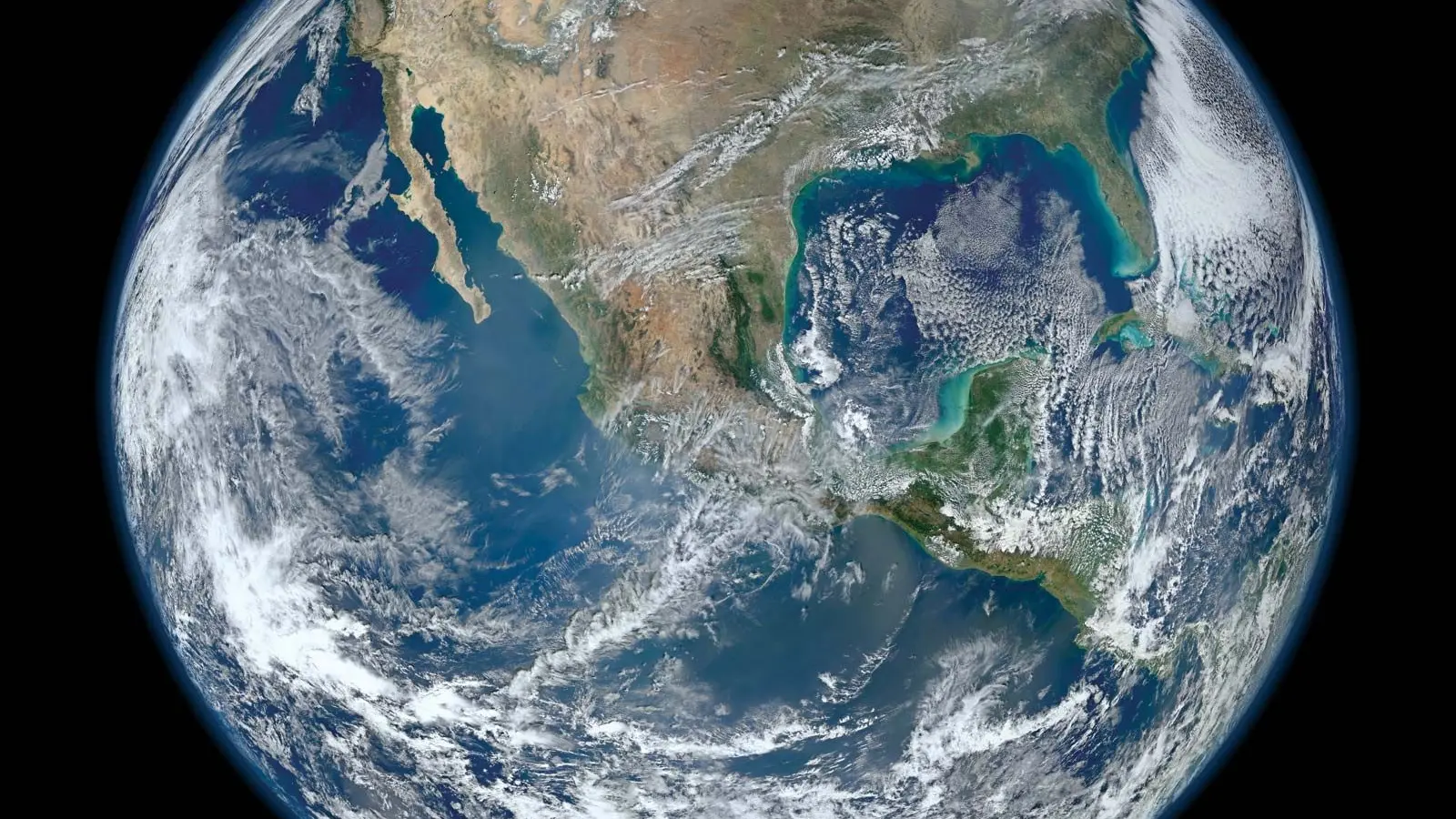
At first glance, world maps give the impression that land and sea are evenly spread across the globe. In reality, most of Earths continental crust is concentrated in one hemisphere. This uneven distribution is not the result of chance alone or any external design; it reflects the long-term, dynamic processes of plate tectonics, seafloor spreading, and continental assembly and breakup that have shaped our planet for billions of years.
Geological background: plate tectonics and supercontinents
Continents ride on rigid tectonic plates that float atop the convecting mantle. These plates diverge, converge, and slide past one another, driven by mantle convection, slab pull, and ridge push. Over hundreds of millions of years, these processes rearrange continental masses: rifts open oceans, mid-ocean ridges create new seafloor, and subduction zones recycle oceanic plates back into the mantle.
One of the central patterns of Earth history is the cycle of supercontinent assembly and fragmentation. Roughly every 300–500 million years, many of the world’s continents come together to form a supercontinent—an extensive landmass containing most of Earths continental crust. Pangaea, the best-known example, existed from about 336 million to 175 million years ago and brought nearly all continents together. Before Pangaea there were older supercontinents such as Gondwana and Rodinia, and the cycle has repeated multiple times over deep time.
.avif)
Why the current distribution is temporary and partly coincidental
The present-day concentration of land in one hemisphere is a snapshot in a profoundly active tectonic system. After Pangaea broke apart, the continents migrated to form the current arrangement: the Atlantic Ocean opened as North and South America separated from Europe and Africa, and the Pacific Ocean has been shrinking in some regions while expanding in others. As a result, if you view Earth from certain vantage points—say looking down on the Pacific—you see mostly ocean. From the opposite view you see large continuous swaths of land across Africa, Europe, and Asia.
These positions are transient. The Atlantic will continue to widen slowly as seafloor spreading adds new oceanic crust at the mid-Atlantic ridge. Simultaneously, subduction around the Pacific tends to consume oceanic plates and can draw continents closer in other directions. Over tens to hundreds of millions of years, these competing processes redistribute continental blocks, so there is no stable, permanent pattern that keeps most land in one hemisphere forever.
Key examples and evidence
Matching coastlines and fossil records
Classic evidence for past continental configurations includes matching coastlines—most famously the complementary margins of South America and Africa—and consistent fossil assemblages across now-distant continents. Rock types and mountain chains that align when continents are reassembled also support past supercontinent configurations. These lines of evidence underpin the theory of continental drift and modern plate tectonics.
Seafloor age and ocean basins
Marine magnetic anomalies and radiometric dating show that the seafloor is youngest at spreading centers and older toward subduction zones, documenting continual creation and destruction of oceanic plates. The relative youth of the oceanic crust compared with continental crust explains why ocean basins evolve rapidly and why continents can cluster or disperse depending on plate motions.
Future supercontinents and long-term outlook
Geodynamic models and plate reconstructions predict that continents will keep moving. Several possible scenarios for the next supercontinent have been proposed, with names like Amasia, Pangaea Proxima, and Novopangaea. These projections differ in specifics—whether the Atlantic closes or the Pacific closes first—because mantle flow patterns, plate boundary evolution, and continental collisions are complex and partly stochastic.
The implications are more than academic: supercontinent cycles influence global climate, ocean circulation, sea level, and biodiversity patterns. When continents aggregate, ocean basins shrink and continental interiors become more arid; when continents fragment, new shallow seas and coastal environments can spur evolutionary diversification.
Expert Insight
Dr. Elena Marquez, a geodynamicist at a university research center, notes: 'The current clustering of land in one hemisphere is a transient configuration shaped by millions of years of plate motions. Viewing Earth at any single moment can be misleading—the long-term record shows repeated assembly and breakup. Understanding that cycle helps explain past climate shifts and guides models of future continental reorganization.'
Conclusion
In short, continental clustering on one side of the planet is a temporary outcome of plate tectonics and supercontinent cycles. Continents continually drift due to mantle dynamics, seafloor spreading, and subduction, so the global arrangement of land versus sea changes over hundreds of millions of years. Past supercontinents such as Pangaea and Gondwana demonstrate this recurring cycle, and future rearrangements are expected as plate motions persist. For observers in space, Earth may sometimes look like a blue marble dominated by ocean, and other times show extensive landmasses concentrated on one hemisphere—both are natural chapters in Earths long geological story.
Comments
skyspin
Good read but feels a bit deterministic? Plate motion is messy, predictions like Amasia sound neat, but uncertain 🤔
Marius
Worked on a marine geomap project once, saw oceanic crust ages for myself. Makes sense, tho those reconstructions change a lot.
labcore
Hmm, is this even true? Seems plausible but how do models account for chaotic mantle flows, real data pls?
atomwave
Wow, that blew my mind! So continents cluster then drift, like tectonic shuffle over eons... kinda poetic, lol
Leave a Comment